|
|
ENKL - Klanten 
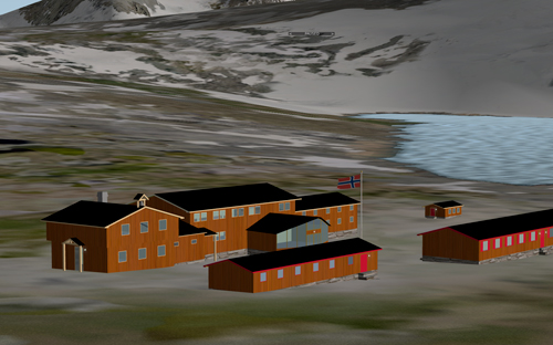
Included Storefjell Mountain Hotel, Eidsbugarden Hotel with a sea lane, Juvass Cottage with a sea lane and Knut Vaale Cottage on the top of Galdhřpiggen.
You shold also download ENGF Leirin Airport for the complete routes. |
|

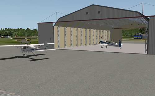
Photo of the real airport, by sailsport.no - Marine Photography |
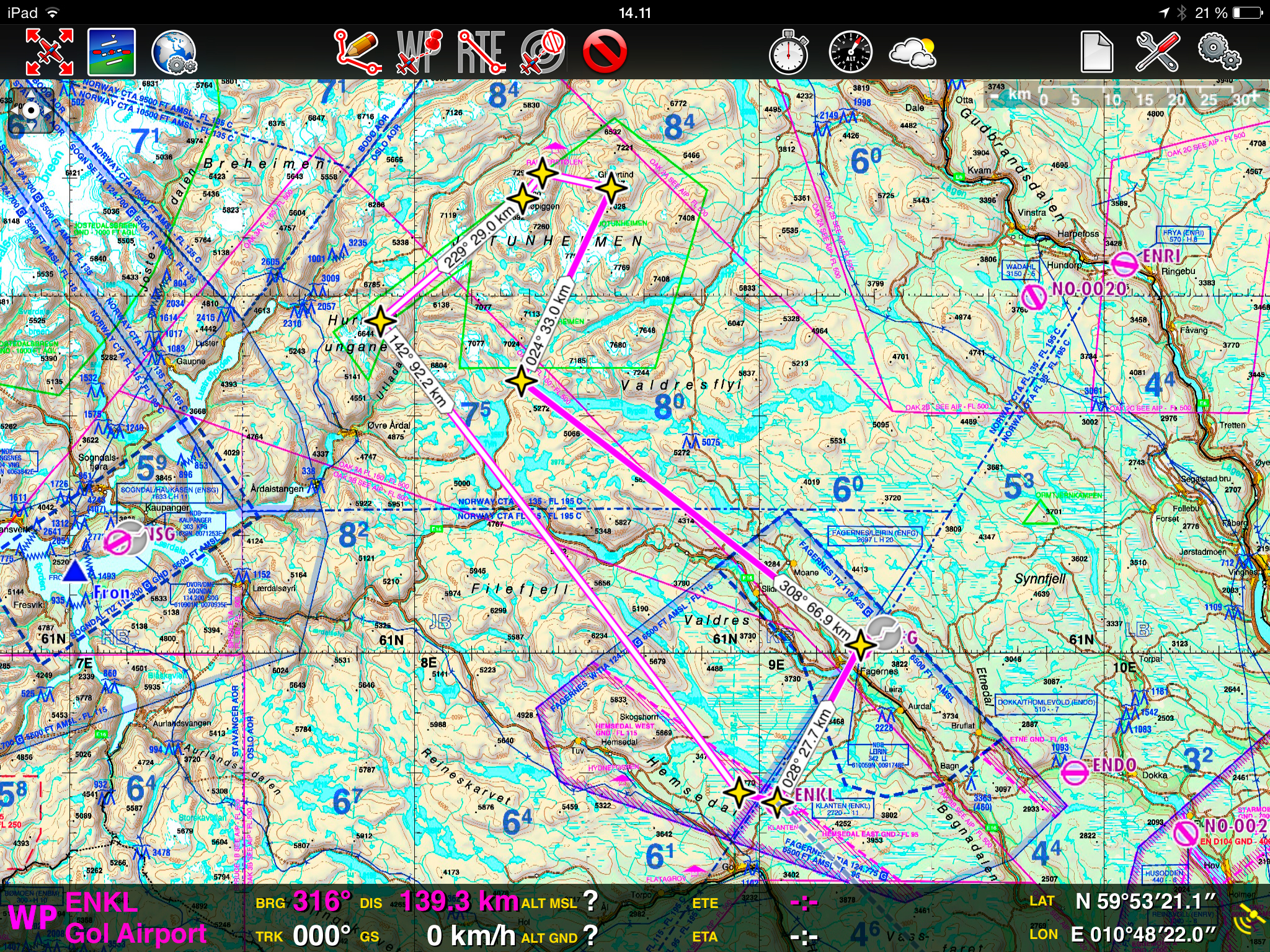
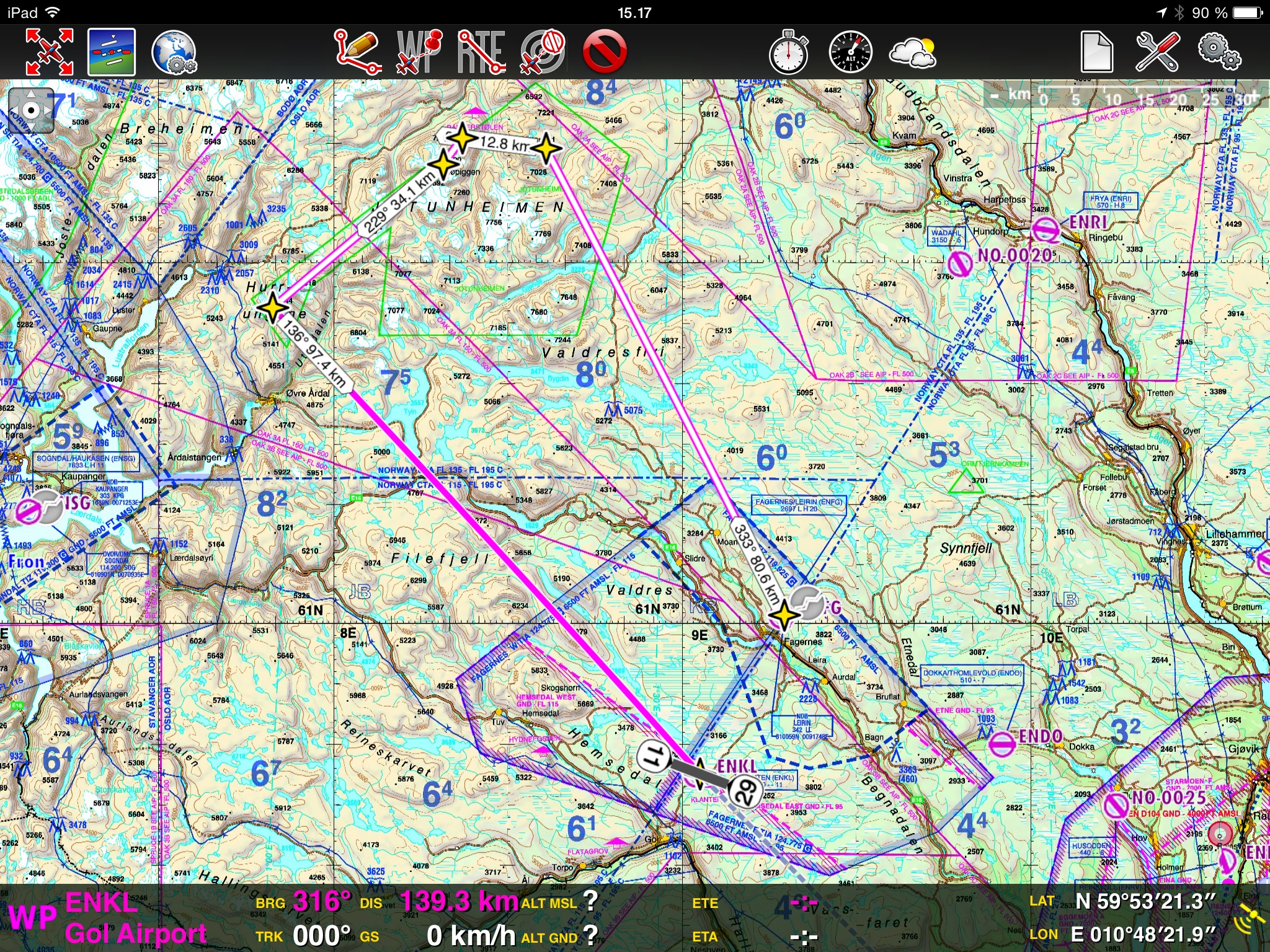
Distance from Klanten to Jotunheimen ca. 130 km. Here you will find Eidsbugarden with a sea lane, Juvass Cottage with a sea lane and Knut Vaale Cottage on the top of Galdhřpiggen, the highest mountain in Northern Europe. Storefjell Hotel is just 4,9 km from Klanten.
The airport is localized 27.7 km from ENFG Leirin Airport, in direction 028 degrees against Leirin. The airport is the base for Klanten Flyklubb, an aero club for motor plains and gliders. This is an airport only for small aircrafts, 1 and 2-props. The runway has no lights, but are marked with red cones. The taxiway is marked with blue cones. The runway has 1150 m grass with 660 m asphalt in the middle. The airport is 4,9 km from the mountain hotel, Storefjell Hotel.
The airport, together with ENFG Leirin, is a fine opportunity to make short flights between two airports for approach and take off training.
Storefjell Hotel, Eidsbugarden Hotel, Juvass Cottage and Knut Vaale Cottage are famous places you can overfly, or you can land on the sea lanes with a sea plane. There is no landing facilities for wheel planes except ENGF and ENKL. |
|
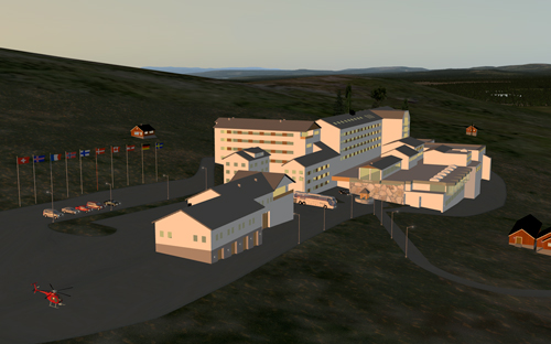
ENKL Klanten 1.0.0. Scenery for X-Plane 10.0 +
The scenery is very detailed and as close to the real as possible for this use. All vehicles, static aircrafts and buldings are made with transparent windows. There is about 15 new objects in the package. Floodlight from hangar openings and facades without HD rendering settings. Navlights and stroblights on some of the static airplanes. Runway overlayed with polygon textures close to real with a sharp view, also from an acute angel.
The buildings are created by me, but basic objects of static aircrafts, vehicles and some other objects come from Google 3D Warehouse. All these objects are modified for X-Plane and retextured by me.
As mentioned, the airport is, in real, without lights, but I have marked it with lights in X-Plane, making it possible to fly in night.
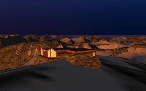
A route plan and maps are included in the package, making you able to take off from Leirin or from Klanten to explore the buildings and mountains in Jotunheimen. There is no landing facilities for wheel planes in the mountain near the buildings unless you fly with a helicopter or a seaplane. Eidsbugarden and Juvass cottage have sea lanes marked with white buoys/red flag. On the top of Galdhřpiggen you will find Knut Vaale Cottage. On the top of Glittertinden you will find a Red Bull helicopter if you are a good navigator.
If you fly a wheel plane, prop or jet, you have to hit the pause button (P) when you are over the destination and explore from there.
In the X-plane airport register:
Eidsbugarden sea lane: EIDS
Juvass cottage sea lane: JUVA
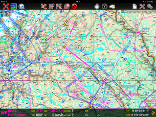
ICAO - map with waypoints.
Click map to enlarge and download |
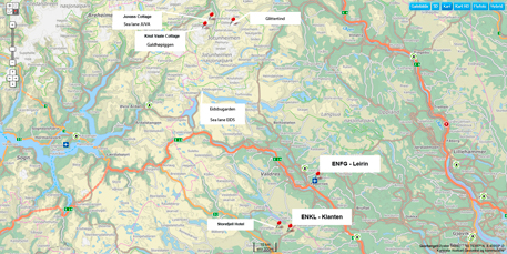
Map with destinations.
Click map to enlarge and download |
The hole package is totaly 133 Mb, (zip 28,6 Mb. It is made with Sketchup and WED and you need Open Scenery installed.
It runs smooth on a Mac Book Pro Retina
2.6GHz dual-core Intel Core i5
Turbo Boost up to 3.1GHz
8GB 1600MHz memory
with these settings:
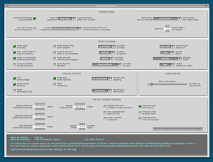
Click picture to enlarge
|
Thanks for all help to:
X-Plane Org. Forum
Google 3D Warehouse by
Airport Crew and Valdres Flyklubb |
Runs well with XP 10.00 and 10.30 update.
NOT tested on Windows PC or other computers, so I welcome feedback from other users.
Installation:
Download the package, unzip the file and place the folder : "ENKL Klanten" in your Custom Scenery folder. (Route maps are in the folder "Maps"). ( It should look like this: X-Plane 10 / Custom Scenery / ENKL Klanten )
It is NOT allowed to redistribute any of these objects in other scenerys without permission. kontakt(at)sailsport.no
|
Comming soon:
A new small airport, close to this one and ENFG Leirin is under Construction:
ENDO - Dokka Airport, Thomlevold, 7 km west of Dokka. Runway 750 m grass. Used by Land Aero Club.
|
|
|
|
|
|
|
|
|


